Tom Roe | Geelong @ 1 Million
Council Candidate for Bellarine, City of Greater Geelong, 2017
21591
page-template,page-template-full_width,page-template-full_width-php,page,page-id-21591,ajax_fade,page_not_loaded,,select-child-theme-ver-1.0.0,select-theme-ver-4.1,wpb-js-composer js-comp-ver-5.2.1,vc_responsive
 

Geelong @ 1 Million

MY PLAN FOR GEELONG: 1 MILLION PEOPLE BY 2060

Melbourne – that city of 4.5 million situated on our doorstep – is currently growing by at least 1 million people every 10 years. That is not going to change. Over the next five decades Melbourne will swell to over 9 million people.

Geelong can’t expect to remain a “large country town”, with pastoral attitudes operating at a rural pace when there is an overcrowded mega-metropolis just 75 kilometres down the road. We’ve got lifestyle and geographic advantages to burn, but as Melbourne swells to bursting point, Geelong is going to find itself facing new challenges, rapidly changing conditions and unrealistic community expectations.

To meet these challenges and make the most of our incredible advantages, we need not only a vision, but also a plan that reflects the urbanisation of that vision.

While leveraging off the City of Geelong’s important Our Future document, I have developed a plan that illustrates my vision for Greater Geelong in 50 years time. I call it “Geelong @ 1 million | A Clever and Creative Future, a 21st Century City”.

The reality

I want us to start planning for the day when Geelong’s population reaches 1 million people.

In my view, this growth is inevitable so we need to start planning for it now. It is not going to happen overnight, but it is going to happen. Based on current growth predictions, Melbourne’s population is likely to grow by close to 3.5 million people over the next 35 years (to around 8 million people) and that city is going to look to regional Victoria to take part of the load.

The Geelong region, including the Bellarine, will be front and centre of that endeavour.  Indeed, it is happening right now with all sides of politics talking to policy settings to encourage that very objective.  In my view, a population of at least 1 million people in the Geelong region over the next 50-70 years is inevitable, and it may occur much sooner.  It will bring economies of scale, new investment and opportunities, and it will bring challenges.

We need to start articulating a plan to not only control our destiny, realise our potential and lead our politicians with confidence, but also to place the necessary pressure on the State and Federal governments to build the infrastructure that the Geelong region will need to accommodate 1 million people.

We need that infrastructure delivery before the population growth – not after it.  The last thing we need is to have Melbourne’s transport and infrastructure mistakes being replicated in Geelong and the Bellarine.

The Plan

My plan is predicated on a number of constraints.

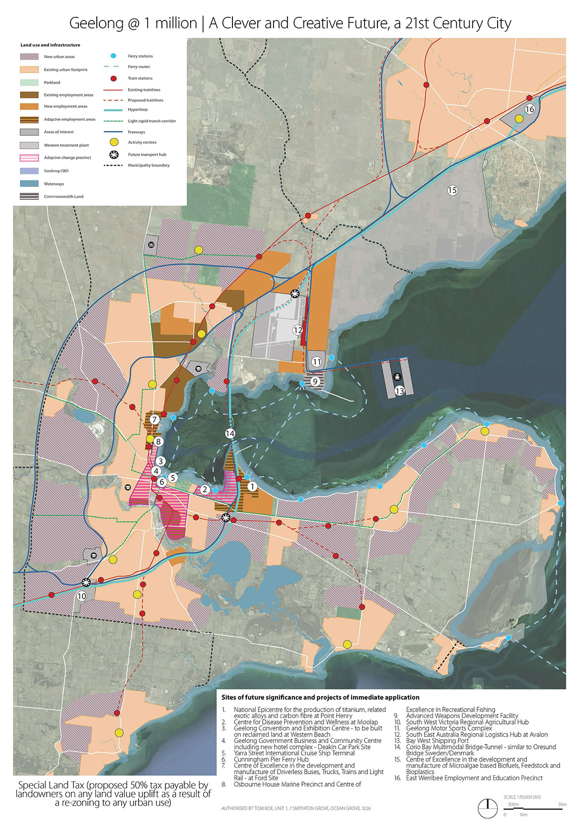
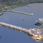
I have required a new gateway entry to Geelong via Point Lillias and across to Point Henry utilising a bridge-tunnel concept to accommodate the shipping channel to Geelong Port, similar to the Oresund bridge tunnel linking Sweden and Denmark.  Corio Bay and Point Henry would in effect become the new gateway into Geelong.

This bridge-tunnel would be multi-modal, accommodating road transport, cycling and a rail loop servicing an intra-Geelong metro rail network.

In addition to the intra-city/region rail system, I’ve also proposed a new fast rail service linking Geelong to Melbourne.  For the purposes of this plan, I am proposing that the fast rail be based on the Hyperloop concept or the Japanese Maglev system.

The Fast Rail would eventually extend to Colac, Warrnambool and Portland, thereby opening up a large part of Western Victoria to further urbanisation, growth and employment opportunities.

The new conventional intra-rail loop would now be focused on servicing the needs of Greater Geelong rather than for inter-city commuter movements, and is proposed to extend to both Drysdale and Ocean Grove, as well as Torquay.

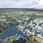
As a result of these infrastructure investments, and a focus on a north/south intra-metro rail system, northern Geelong would accelerate its evolution to being an aspirational place to live, with higher living densities, employment opportunities, housing gentrification and reinforcement of east/west links to the Corio Bay edge, bringing the water to the people.  We have to make better use of, and easier access to, our stunning bay.

The plan also provides for a number of light rail services to service both existing and emerging communities.  The current ring road has been extended to Point Henry, and this plan incorporates a new outer metropolitan ring road as a hard boundary to the city.

These ideas or concepts are not new (and a number have been recently in the public domain), but they were always good ideas, and in respect to the envisaged road infrastructure, are consistent with a VicRoads 2040 proposed road plan.

New intra-Geelong ferry services are also proposed, with a central hub situated at Cunningham Pier connecting the Bellarine and Avalon with the CBD.

I have also adopted Infrastructure Victoria’s “Point Wilson” option for Victoria’s new container port.

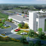
A number of dedicated large scale employment precincts have been proposed. There precincts would be in addition to the more traditional and complementary lower order employment areas in conventional residential/urban areas.

Where do we put 1 million people?

To accommodate 1 million people – and despite proposed increases in people densities in the inner Geelong city area – the urban footprint needs to pivot west, north and east into the Bellarine.  Moreover, a pivot to the east will make much better utilisation of the proposed bridge-tunnel across Corio Bay.

This will be confronting for the Bellarine, but at the same time the load and extent of change is shared across the whole municipality, and there is, in my view, balance and logic to the plan.

To accommodate this growth, a great deal of new land will need to be re-zoned to permit further urbanisation of the region, including residential, employment, retail, recreational parkland, sporting complexes and other community facilities.

How do we pay for it?

An obvious consequence of the necessary re-zoning is that some land owners will have windfall gains.  A critical part of my plan is that those windfall gains are taxed at a meaningful level, and that all the revenue raised through this tax is invested in infrastructure support and delivery for Greater Geelong.

Specifically, I propose that from this point forward, any land that is rezoned within the municipality, that directly results in a value uplift, will be subject to a Value Capture or Special Land Tax (VCT).

The level of the tax would be applied at 50% of the uplift attributed to the re-zoning (to be independently determined), and would be payable at the first liquidity (cash) event after a Development Plan (DP), Precinct Structure Plan (PSP) or similar has been approved by the responsible planning authority and which allows development consistent with the underlying new zoning.

It would in effect be like Melbourne’s GAIC, but would apply across the entire region/municipality, not just “growth areas”.  Developers and/or land owners would still be subject to the usual developer contributions currently payable (in addition to the VCT if applicable), which are used to fund community infrastructure, roads, etc. within their respective projects.

Also, I propose that Council advocate to the Victorian State Government that a percentage (at a meaningful level to be agreed, but say 50%) of all collected property taxes in the region (specifically, property stamp duty and land tax) be set aside for shorter term infrastructure funding and special project support in the municipality.

This would provide Greater Geelong with a growth tax and a reliable source of asset funding outside that of standard Council rates.  The usual annual State Government grants to Council would of course need to be reviewed in this context.

Notwithstanding my proposed tax arrangements, there would still be a requirement for considerable specific purpose grants from both the Victorian State Government and the Commonwealth to fund the big picture infrastructure such as intra rail, fast rail and the proposed bridge-tunnel – they would be beyond any local funding capacity and should be considered infrastructure of both state and national significance.

To deliver this plan and envisaged projects, I need your support and mandate. So Vote 1 Tom Roe as one of your three Councillors for the Bellarine.

PROJECTS TO KEEP US GROWING

As Geelong grows towards 1 million people, it will need to launch new industries, become a centre of excellence for some businesses and a hub for others. We need to be thinking creatively and identify the industries and the investments that are going to be critical not just to Geelong’s future, but to the world.

Key Proposed Projects of Immediate Application

National Epicentre for the production of titanium, related exotic alloys and carbon fibre at Point Henry

Would include the development of an additive manufacturing and 3D printing industry. A particular focus would be on bio-medical 3D printing, and the aerospace, marine, shipbuilding and defence sectors. I also propose that the Commonwealth’s upcoming $35 billion SEA 5000 Future Frigate Programme be delivered at Point Henry rather than Adelaide.

Centre for Disease Prevention and Wellness at Moolap

Incorporating a Health Care Hub providing international medical and healthcare tourism. In the early phase, the hub would be focused on wellbeing, preventative care, and tailored/3D printed bio-medical parts, prosthetics and mobility assistance devices. In the second phase, the Centre would move into invasive surgery, related advanced medical procedures including bio-ink tissue creation (utilising stem cell technology) and ultimately 3D printed organ replacement.

Geelong Convention and Exhibition Centre

To be situated on proposed new reclaimed land on the water at Western Beach rather than at the Deakin car park site, and incorporating a building of international architectural significance: Geelong’s equivalent of the Sydney Opera House.

Geelong Government Business and Community Centre

Would provide for the amalgamation of Council administrative departments, Victorian State and Commonwealth Government regional based departments (most particularly DELWP, DEDJTR and RDV), a proposed Geelong Ports, Rail, Logistics and Ferry Authority and a new Geelong hotel complex to further enhance the tourism offer and support regional investment. – Deakin Car Park Site

Yarra Street International Cruise Ship Terminal

Cunningham Pier Ferry Hub

A similar concept to Sydney’s Circular Quay.

Centre of Excellence in the development and manufacture of Driverless Buses, Trucks, Trains and Light Rail, and Graphene based battery storage

To be based at the former Ford manufacturing plant, the facility would also focus on the development and manufacture of graphene-based battery storage.

Osbourne House Marine Precinct and Centre of Excellence in Recreational Fishing

With the imminent banning of netting in Corio Bay, and ultimately Port Phillip Bay in 2022, the waters surrounding Geelong will become a recreational fishing mecca.

Consistent with a 2007 Council masterplan and feasibility on the development of Osbourne House as a Marine Precinct, proposed is the creation of a Centre of Excellence in Recreational Fishing. The complex would not only allow for motor boat access, maintenance and on-shore storage, but also education and support for sustainable recreational fishing within Corio Bay and nearby waters.

The facility would provide for education in fishing, various fish species, humane killing, preparation of fish for human consumption and cooking techniques. Ideally the facility would incorporate fish ponds and allow for the trading of live and healthy fish caught within Geelong region waters. The sea level ponds would also allow for controlled onshore family fishing as a further enhancement of the tourism offer.

Advanced Weapons Development Facility

The Commonwealth owned facility at Point Wilson provides for approximately 300 ha of underutilised defence land that has historically been used for the Defence Force’s required regional importation and storage of Explosives Ordinance, similar to a number of other facilities around the country.

I understand it is not operational due to the existing infrastructure having reached the end of its economic life.

An upgrade of the facility is currently proposed and due to commence in 2018. I propose that in addition to the support of the Explosive Ordinance requirement, that the facility be further enhanced to leverage off the advanced manufacturing capability in Greater Geelong and the proposed development of the Point Henry Epicentre for the production of titanium, related exotic metals, carbon fibre, and additive manufacturing industry, and accommodate a new advanced weapons development facility (this would include a focus on submarines drones and other marines based military hardware).

South-West Victoria Regional Agricultural Hub

The proposed facility would incorporate a new regional livestock exchange, fresh food education centre, large scale Dutch glasshouses, meat preparation and fresh produce market (both wholesale and retail). It would be a showcase of regional food sourced from Victoria, and would also incorporate a proposed new food education centre promoting the use of fresh food for all age groups.

Geelong Motor Sports Complex

The complex would incorporate the proposed $80 million Victorian State Government Crash and Trauma Education Centre and have added a F1-certified race track for vehicle testing and public access motor racing as well as additional track facilities supporting other disciplines such as Motocross and Drag Racing.

South East Australia Regional Logistics Hub at Avalon

Air/Sea/Rail terminal

Bay West Shipping Port

Consistent with Infrastructure Victoria’s Point Wilson option.

Corio Bay Multimodal Bridge-Tunnel

Multimodal transport link providing an eastern bypass of Central Geelong and connecting Moolap, the Bellarine, and Geelong’s southern suburbs to Avalon and Melbourne.

Centre of Excellence in the development and manufacture of Microalgae based Biofuels, Feedstock and Bioplastics

To be located at Western Treatment Plant– our sewage is going to be put to work while the growth of microalgae for Green Crude will absorb CO2.

East Werribee Employment and Education Precinct

As currently proposed by the Victorian State Government

THE BASIS FOR THE PLAN

This map is a strategic vision of the Geelong region following the expected population growth of approximately 750,000 people over the next 50 years. The map speculates on the potential distribution of growth along key corridors, and highlights particular projects and infrastructure which could advance Geelong as an economically viable and globally connected city of 1 million people.

This strategic vision does not necessarily reflect all environmental, social or economic constraints of the potential growth corridors and is only intended to provide an example of how growth could be distributed over the 21st century.

Population Projection Methodology

2016 Census data provides the basis to this projection, as well as the number of dwellings per hectare found in exemplar greenfield and infill developments in other parts of Victoria.

The 2016 Census provided an Estimated Resident Population for Greater Geelong as 238,000 people. An additional 22,000 people (approx.) live in adjacent settlements in neighbouring municipalities (such as Torquay, Queenscliff and Bannockburn).

With Victoria’s population growth at unprecedented levels, this plan provides an alternative future of a bigger Geelong that plays a greater role in supporting Victoria’s growth. The strategic vision is a preliminary blueprint of where between 650,000 and 850,000 additional residents could be accommodated in the Geelong region.

New Urban Areas

These new areas will provide an additional 22,000ha of land, 17,500ha of which would be developed for housing, providing between 13 to 18 dwellings per hectare (resulting in 230,000 to 315,000 additional greenfield lots). Dwelling densities per hectare in these greenfield areas would generally be higher in places with close proximity to services and transport, and lower in other areas (such as along the Bellarine).

With an average of 2.4 persons per household in Greater Geelong (Census 2016), this could allow between 550,000 and 750,000 people in these new urban areas in the north, west and the Bellarine.

Adaptive Change Precincts

These precincts would cover much of Geelong inner suburbs (including Moolap) and allow for increased densities to be provided in appropriate locations to increase populations in areas that have existing infrastructure that can be adapted to support growth.

The two Adaptive Change Precincts have a total area of 1,742ha, and on balance would be able to provide between 15 to 20 dwellings per hectare across established areas (26,000 and 35,000 townhouses and apartments). Based on an average of 2.1 persons per household in inner Geelong (Census 2016) this would result in an additional 55,000 to 74,000 people within these areas (in addition to the existing population).

Torquay Growth Area

The plan identifies some greenfield growth potential immediately north and west of the existing and planned Torquay settlement. With planning for the Surf Coast Rail Link entering preliminary stages (resulting in a significant infrastructure investment in Torquay), it is important that areas of the Surf Coast Shire (where possible) provide land to support the growth of the Geelong region.

This new growth area would provide 1338ha of land, 1070ha of which would be developed for housing providing between 13 to 18 dwellings per hectare resulting in 14,000 and 20,000 additional greenfield lots. With an average of 2.4 persons per household in Torquay (Census 2016), this could allow between 33,000 and 48,000 additional people in this area.

Percentage of Urban Land in Greater Geelong

The City of Greater Geelong covers a land area of 1,247km2, of which 242km2 is covered by urban settlements that include Geelong itself, as well as surrounding settlements (such as Lara and along the Bellarine Peninsula). This represents an existing urban coverage of 19% of all municipal land.

The proposed changes will add an additional 218km2 to the municipality’s urban footprint, increasing coverage to 36% and leaving almost two thirds of all land undeveloped.